Welcome to GISWeekly!
GISWeekly examines select top news each week, picks out worthwhile reading from around the web, and special interest items you might not find elsewhere. This issue will feature Industry News, Top News of the Week, Acquisitions/Agreements/Alliances, Announcements, Contracts, New Products, and Events Calendar.
GISWeekly welcomes letters and feedback from readers, so let us know what you think. Send your comments to me at Email Contact
Best wishes,
Susan Smith, Managing Editor
Industry News
Casting a Vote for GIS-enabled Election Software
by Susan Smith
Since the 2004 election, many new developments that utilize GIS software have taken place in election software. Companies such as Philadelphia-based Avencia Incorporated and Committee of Seventy have stepped up to the plate to use GIS to address some of the protection challenges for voters and create a safe, secure voting experience for everyone in the U.S. At the other end of the spectrum, Hart InterCivic and ESRI have entered into a relationship to develop a GIS-enabled election management system to enhance election processes at the state and local government levels.
According to Robert Cheetham, president and founder of Avencia, a GIS and software development company, the upcoming 2008 presidential election season will be an exciting time filled with activities such as the primaries, caucuses and straw polls, before the big general election in November. The 103-year-old Committee of Seventy conducts the oldest and largest regional voter protection program in the U.S., the Election Oversight Program. For the most recent election of a new mayor and city council, the Committee partnered with Avencia to help geographically, map, record and analyze election day incidents in real time.
The Committee works with the Lawyers’ Committee for Civil Rights Under Law on Election Day to coordinate a program to monitor and register election incidents.
A small firm of approximately 20 employees, Avencia has been around since 2000. Their focus is building web based GIS software products. According to Cheetham, a fair amount of their business is local, state and federal government, and they also serve non profits, academic institutions and private businesses.
The Committee runs a hotline where citizens and volunteers can call in with polling place questions, and reports of problems at the 1,076 polling places. The information is logged, then teams, volunteers, attorneys and representatives from the district attorney’s office to interview witnesses and make sure there is integrity in the voting place.
“Think of it as a 911 solution for Election Day,” said Cheetham.
The new GIS system would facilitate easy and fast recording of incidents and real time map generation Key advantages include:
1) At the operation center, teams are assigned to each section of the city. Maps help them visualize as the incidents come in so they can assign teams more effectively.
2) On Election Day, officials are able to more effectively communicate to the media when there are serious problems.
3) After election summary reporting to public, to summarize problems present in the election.
Prior to the GIS, the Committee worked with a wall paper map on Election Day.
If any charges or citations are made, the district attorney must be involved. “There’s a call center that logs the incidents into an Election Incident Reporting System (IRS),” explained Cheetham. “The IRS is a web based system run by another non profit, operated nationally. We’re able to extract data out of there electronically and then bring it into ArcGIS Desktop to map and run a series of geoprocessing models every half hour or so to produce summary results. The summary results are exported as PDF files and emailed out to all the teams.”
Since last fall, Avencia has been working on a proposal to build a web-based, fully automated system, whereby when the incidents are logged, they’re immediately available to everyone. This will eliminate the more time consuming desktop component and make it a fully web based application.
Cheetham said the Committee of Seventy envisions taking their election monitoring work out to the metro area surrounding Philadelphia. Ultimately, if their automated system is well received locally, they hope to take it across the country to other jurisdictions.
Hart InterCivic and ESRI Relationship
Hart InterCivic, a company that has been a leading government services technology provider for almost 100 years, has recently partnered with ESRI to develop and offer GIS solutions to the election community. Hart InterCivic’s role in county and state government has evolved from printing forms and ballots to their current role as an industry leader in election technology. Answering the call of the 2002 Help America Vote Act, Hart first entered the electronic voting age with a voting machine specifically designed to accommodate the needs of voters with disabilities.
“From there Hart’s focus has been on security and reliability and always giving the voters a choice, be it paper ballots or electronic voting, ” said Betsy Doty, product manager for Hart InterCivic. “We run the full gamut of voting solutions, offering both electronic and paper based systems, as well as disabled access.
Doty said Hart InterCivic is one of four main voting vendors.
 [
Click to Enlarge ] [
Click to Enlarge ] |
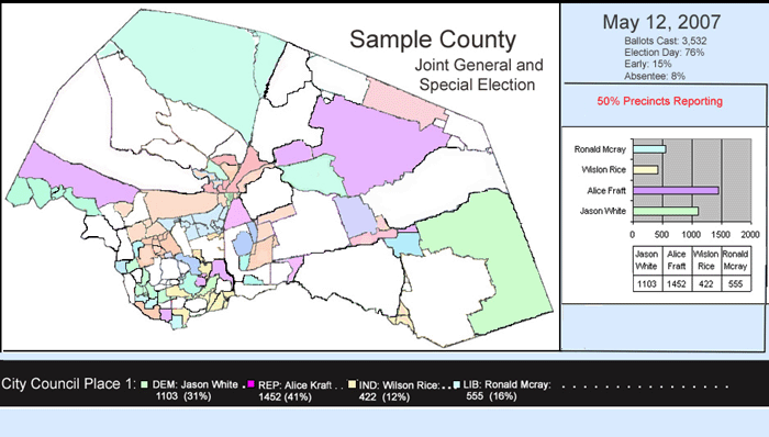
They took a recent prototype for election night reporting to the National League of Cities Conference in New Orleans, where it was favorably received. The prototype is a visualization of real time election results displayed on a map.
“We’ve been doing election night results for a long time and we’ve already integrated with other election vendors so the solution is not limited to only our customers. We can display these election night results for any county or any state,” explained Doty. A map showing the election precincts is displayed and the winners are color coded to show winners by precinct or, if this were a state-wide application, by county.
“Other applications such as a polling place locator and a ballot preview are natural extensions of GIS technology.”
Doty said they are very excited about combining ESRI’s GIS technology with Hart’s election knowledge and experience. “We do all we can to help our customers with the election process, and this will be one more opportunity to do that.” concluded Doty.
Top News of the Week
Merrick & Company, a leader in LiDAR, digital ortho imaging, photogrammetry, and geospatial solutions was awarded a $569,000 contract with the City of Chihuahua to deliver aerial photography, 3-meter LiDAR data, 20-centimeter pixel resolution digital orthophotos, a DTM to support 0.5 meter contour extrapolation, planimetric data, and delivery of Merrick’s MARS® software. Awarded in June 2007, final delivery of all data products is planned for March 2008.
Commercial third-party software Freeance Web 5.0 reduces time and effort needed to create Web mapping applications and increase functionality with ArcGIS Server for local governments:
City of Palm Desert CA
Needed multiple templates that can be modified and connecting many different databases to ESRI MXD and AXL map services. Also required PDF printing for end-users.
City of Arvada CO
Needed database connecting and better layer control for end users. Also needed control over the placement and layout of the results tables from queries and feature identify functions.
Centre County PA
Just installed ArcGIS Server. Currently running ArcIMS and needs to replace ArcIMS web apps with ArcGIS in 2008. Wanted a non-programming solution for in-house development.
Acquisitions/Agreements/Alliances
Intermap Technologies Corp. announced its partnership with Autodesk as an Independent Software Vendor (ISV). Intermap's highly accurate 3D elevation models for the United States will be combined with AutoCAD Map 3D and Autodesk MapGuide Enterprise applications to enable users to gain access to terrain mapping data essential in a wide range of applications and markets. Intermap's solutions are designed to enhance the business of Autodesk and their mutual customers in several engineering and geospatial markets by providing a solid foundation layer of terrain data essential to the accurate planning, modeling and visualization of any application where elevation matters.
Announcements
Safe Software announced that its recent donation of FME, the world’s only true spatial ETL (extract, transform and load) platform, will assist the United Nations Environment Programme’s World Conservation Monitoring Centre with critical conservation decision-making around the globe. The grant, which consists of both FME software licenses and training credits, will replace costly, labor-intensive processes by enabling the World Conservation Monitoring Centre to streamline data loading into a World Database of Protected Areas (WDPA). Information provided by the WDPA is an essential guide to global conservation policy development, and conservation priority assessment, planning and monitoring.
GeoWeb 2008 conference organizers are announcing their 1st Student Contest. The annual GeoWeb conference will take place in Vancouver, Canada from July 21-25th, 2008 with the meetings being held at the Morris J. Wosk Centre for Dialogue. GeoWeb is one of the only annual conferences focusing exclusively on the convergence of GIS and the Internet, and the economic potential associated with the convergence of XML, web services and geographic information systems. The GeoWeb 2008 conference welcomes both public and private organizations to meet, discuss and learn about today’s most innovative geospatial technologies.
The theme for the GeoWeb 2008 conference is Infrastructure: Local to Global.
Contest Submittals
Students must register by Friday, April 2nd, 2008.
Azteca Systems, Inc., provider of GIS-centric management solutions, opened online registration for the 2008 Cityworks User Conference, providing attendees an easy and convenient way to review details and register for the conference. This year marks the 8th annual event which offers Cityworks users, business partners, and others a unique opportunity to learn more about Cityworks, spend time with Azteca Systems’ staff, and share experiences and knowledge with others in the Cityworks community.
This year’s Cityworks User Conference will be held June 16 – 18, 2008, at the Snowbird Ski and Summer Resort’s Conference Center at the Cliff Lodge.
For more information on the Cityworks User Conference and to register online, visit Cityworks.com. And, for more information on the Snowbird Resort, visit snowbird.com.
Contracts
Infoterra Ltd, a leader in the provision of geospatial products and services, has been awarded a framework agreement under OGCbuying.solutions' Catalist Geographical Information Services and Solutions framework (GISS), an arrangement that provides a streamlined procurement route for public sector bodies. Under the new Catalist GISS framework, Infoterra has been awarded framework agreements in the GI Mapping Services and GI data supply solutions categories.
New Products
Latitude Geographics announced the availability of Geocortex Essentials 1.2, software that simplifies the process of building enterprise-level applications built on ESRI’s ArcGIS Server and Web ADF technologies. Geocortex Essentials includes a powerful development foundation and ready-to-use tools that simplify the process of creating and managing ArcGIS Server applications.
HP announced new economical servers, application solution "blueprints" and enhanced remote management software that can help midsize companies reduce operating costs while supporting their growth.
The company's entry-level server portfolio now includes four new HP ProLiant server platforms that help midsize customers with limited space, budgets and IT staff. The servers' easy-to-use tools guide users through system configuration for fast installation so customers can focus on what matters most - growing their businesses.
1Spatial announced the release of version 2.0 of their Radius Studio™ product.
Radius Studio is an enterprise data integration and quality assessment tool that makes comprehensive use of the Oracle technology stack. It provides a data certification platform that ensures the quality and consistency of spatial data located in either Oracle 9i / 10g Databases or in vector file formats accessed via Feature Data Objects (FDO). This solution is delivered in a J2EE architecture that offers web
TatukGIS announced the release of the .NET Compact Framework edition of the TatukGIS Developer Kernel toolkit product for the development of custom GIS applications for Pocket PC type applications for Windows CE/Mobile operating systems. The DK-Compact Framework (DK-CF) product supports Windows Compact Framework 2.0 development with Visual Studio 2005 and Compact Framework 2.0 and 3.5 development with Visual Studio 2008.
DMTI Spatial (DMTI), a leading provider of Location Intelligence, has announced the availability of DevZone, a robust, feature rich, software development platform for developers interested in creating innovative Location Intelligence applications. Leveraging DMTI’s breakthrough Location Hub™ platform, DevZone’s web portal gives users access to a myriad of services including online resources for developers, such as geocoding services, address recognition services, online demonstrations, forums and wiki-styled documentation.
Upcoming Events
| Mapping California Communities Workshop: An Introduction to GIS and Community Analysis | |
| Date: | January 23, 2008 |
| Place: | ExecuTrain 2005 De La Cruz Blvd,
Ste 200 , Santa Clara, USA |
| Participants will learn how to easily create thematic maps of their own data and display spatial trends in information. | |
| Mapping California Communities Workshop: An Introduction to GIS and Community Analysis | |
| Date: | January 25, 2008 |
| Place: | University Business Center 5245 N Backer Ave,
PB 193 , Fresno, USA |
| Participants will learn how to easily create thematic maps of their own data and display spatial trends in information. | |
| Mapping California Communities Workshop: An Introduction to GIS and Community Analysis | |
| Date: | January 31 - February 1, 2008 |
| Place: | ExecuTrain 210 Spear
San Francisco, USA |
| Participants will learn how to easily create thematic maps of their own data and display spatial trends in information. | |
| 2008 MAPPS Winter Conference | |
| Date: | January 31 - February 4, 2008 |
| Place: | Westin Mission Hills Resort & Spa
Rancho Mirage, CA USA |
| The Management Association for Private Photogrammetric Surveyors (MAPPS) is the only national association of firms in the surveying, spatial data and geographic information systems field in the United States. MAPPS member firms are engaged in surveying, photogrammetry, satellite and airborne remote sensing, aerial photography, hydrography, aerial and satellite image processing, GPS and GIS data collection and conversion services. Our associate members include firms that provide products and services to our member firms, as well as other firms world-wide. | |
| CA/HI/NV Regional User Group Conference | |
| Date: | February 6 - 8, 2008 |
| Place: | Doubletree Hotel Sacramento
2001 Point West Way, Sacramento, CA USA |
| Join your colleagues for this year’s California Regional User Group Conference to explore the latest software solutions and industry trends. Network with GIS professionals, meet with ESRI staff, and gain real-world insight, strategies, and skills critical to your field. | |
| Map India 2008 | |
| Date: | February 6 - 8, 2008 |
| Place: | India Expo Centre, Expo XXI
Noida, U.P., India |
| Map India, the most successful series of conferences on geospatial technologies held in India since 1998, is poised to enter a new period beginning 2008. As India strives to achieve the outlined goals of overall social and economic development in its 60th year of Independence, Map India too aims to take the development and penetration of geospatial information technologies to an unprecedented level, not just in India but in the entire South Asian region. | |
| Location India 2008 conference | |
| Date: | February 7 - 8, 2008 |
| Place: | India Expo Centre
Greater Noida, India |
| LOCATION INDIA, a B2B platform in the field of Fleet Management, Navigation and Location Based Services, has been designed to provide an opportunity for the industry to come together on a single platform to discuss business, network and benefit from research, analysis and debate on critical market trends and issues. | |
| 2008 3GSM World Congress | |
| Date: | February 11 - 14, 2008 |
| Place: | Barcelona
Spain |
| Welcome to the The 3GSM World Congress is the world’s leading mobile communications conference, forum and exhibition. Held annually since 1994, the event has attracted over 70,000 visitors from 175 countries, more than 1500 exhibitors and 2000 media and press representatives. The 3GSM World Congress in Barcelona promises to continue its dominance of the industry calendar as a crucial week of networking and learning. Whether you are exhibiting or visiting we hope that it proves to be a valuable and productive experience for your organisation. | |
| Geo-Science and Technology: Utilization of Geo-space as solution for Energy and Environment (GTEE-2008) | |
| Date: | February 12 - 14, 2008 |
| Place: | Indian Institute of Technology Kharagpur
Kolkata, India |
| This conference will throw light on the latest developments in excavation technologies, current practices for the utilization of geo-space and effective usage of existing underground space around the world regarding new strategies for further research and development. It will also act as a platform and will provide an opportunity for sharing the latest global know-how among the participants. | |