GISWeekly examines select top news each week, picks out worthwhile reading from around the web, and special interest items you might not find elsewhere. This issue will feature Industry News, Top News of the Week, Acquisitions, Agreements, Alliances, Announcements, People, New Products, Around the Web and Events Calendar.
GISWeekly welcomes letters and feedback from readers, so let us know what you think. Send your comments to me at
Email Contact
Best wishes,
Susan Smith, Managing Editor
Industry News
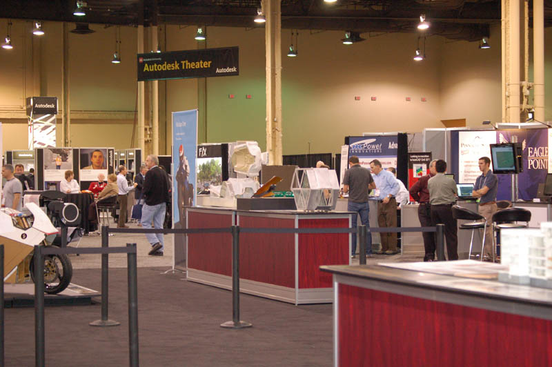
Looking for Geospatial at Autodesk University 2009
By Susan Smith
 |
Driving into Las Vegas this year for Autodesk University, one could not help but notice the large construction cranes standing idle, reminiscent of a boom town Vegas. The sight is a sign of the times, and as you go farther down the Strip, casinos still hold their garish allure for some, yet a climate of faded opulence is palpable.
This year’s AU, held at the Mandalay Bay, kicked off with a General Session/Welcome Address, with beginning remarks by Autodesk evangelist Lynn Allen. CEO Carl Bass began his keynote by saying he was encouraged by “signs that the economy is getting better.”
He added that customers around world say their primary challenge is in trying to stay competitive. Because of the tough economy and more complex projects, customers need to work more efficiently.
Bass’s keynote focused mainly on the areas in which Autodesk has excelled: design, both architectural and mechanical and most recently 3D plant design.
Using a timeline, Bass showed how successful technologies move in a continuum from impossible to impractical, then possible, then to expected and finally to required. He pointed out that flying was considered impossible except by those like Leonardo Da Vinci. It’s required in today’s society. Timing of the technology is a critical factor, if it’s too early, it won’t be embraced, people aren’t ready for it; if it’s too late, it misses the boat. He gave the example of the Newton PDA which was ahead of its time, while now it’s almost required that everyone have a mobile phone with a lot of features. In this continuum there is a sweet spot.
Five design capabilities or technologies are currently moving from impractical into the sweet spot, said Bass:
Exploration, analysis, storytelling, collaboration, and access.
 [
Click to Enlarge ] [
Click to Enlarge ] |
The technological development accelerating these technologies is cloud computing – or web based computing, which is “becoming as cheap and reliable as electricity, so we can take greater advantage of computing power,” said Bass. It is a very big platform shift, and he said a shift like this comes along every ten to 20 years – that changes the way we use computers and do design and engineering work.
An example of the use of this computing power is Autodesk’s Project Twitch, currently in Autodesk Labs, which allows you to access Autodesk software directly from the web running in the distance on a far more powerful machine than your own.
Reorganization
Software companies are all undergoing some internal shifting to accommodate the economic downturn, and Autodesk is no exception.
 [
Click to Enlarge ] [
Click to Enlarge ] |
Consolidation has happened at Autodesk. One vendor noted that in years past, there had been a geospatial section on the exhibit floor devoted to the geo-related companies. There was no Geospatial Keynote this year as there has been in past years. A Utilities Keynote was held on Monday that I did not attend, and a Government Keynote, which I would have thought would focus on geospatial, gave it nary a mention. The attention there was on the integration of BIM into government, and transportation. Some technical sessions addressed the use of Map 3D, MapGuide and Topobase.
If it seems that geospatial is not at the top of Autodesk’s priority list, that’s probably the case right now. Autodesk has been talking about “blurring the boundaries” between products and divisions for years, because there are some areas where customers feel the need for information from other industry segments. Manufacturing customers want to be able to take advantage of BIM models for example, for the management of building products. Autodesk undertook to integrate CAD and GIS because their AutoCAD customers wanted to be able to access minimal quantities of GIS data, without having to learn an entire GIS system. It is the sign of a changing world; perhaps what we’ll see in future is the use of Autodesk’s geospatial products integrated into in-building navigation products, since the built environment is the company’s primary focus.
At a press breakfast at AU, Phil Bernstein, FAIA, vice president of industry strategy and relations for AEC, shed some light on Autodesk’s reorganization, by speaking about what AEC was now at Autodesk.
Last year, AEC was comprised of Building and Civil. Now the AEC division is comprised of building, infrastructure, plant and civil, with civil expanded to include water, wastewater and utilities.
In the past, water, wastewater and utilities were under the heading “infrastructure,” and considered the domain of geospatial at Autodesk, but it seems infrastructure has taken to mean the built environment and therefore utilities, water and wastewater fit into the category vis-à-vis their built needs.
Paul McRoberts, director of the Infrastructure Group, described how Map 3D and Topobase are used to aggregate and reconcile data for reporting back out. Map 3D and Topobase are used for records management and planning for property management. Visualization will be huge in transportation, he said, with the ability of LandXplorer to create visualizations of cities and roads in very little time.
McRoberts talked about utilizing weather data in Green Building Studio for design purposes, looking at erratic temperatures, rainfall, floods; all those weather peculiarities that can impact design, and using technology to predict them.
In a later conversation with McRoberts, he said geospatial is still very much a part of Autodesk, "but designers do not use or leverage GIS data the way they could. Today they see no use for it. We are hoping to change that.”
This is after Autodesk’s spearheading the Open Source Geospatial Foundation, the development of the promising Feature Data Objects, MapGuide and MapGuide Open Source, Map 3D, Topobase and other products that have been notable in the geospatial industry. These products are still alive and well at Autodesk….and a third party developer confirmed that robust new versions of both Map 3D and Civil 3D will be announced in 2010. Another GIS third party vendor said that they only demonstrate their Civil product at Autodesk, not their other geospatial offerings.
3D Laser Scanning
In this past year there has been a growth of interest in 3D laser scanning of the built environment. As Stimulus funding is earmarked for renovation and retrofits of buildings, 3D laser scanning is now a relatively cost effective and very accurate way to aggregate data from existing buildings. Vendors of this technology say that the price has come down so that customers are no longer only large firms, but smaller firms can now afford to have laser scanning done. This scanning can also include lidar data, which of course, is a product of the geospatial industry.
Visualization and Simulation
Autodesk has a heavy investment in the film and gaming industries, and one would wager that the visualization and simulation that we find in geospatial, particularly the high end products that the military and defense industries use - might benefit from the development of these tools.
Producer John Landau of Lightstorm Entertainment gave a presentation on the visual effects used in the movie, Avatar, which is going to debut in theatres soon. Landau partnered with producer/writer James Cameron on this film as well as the Titanic, where he said they “broke new ground in using visualization effects as a storytelling device.”
Avatar is shot fully in what is called “stereoscopic 3D,” using Autodesk technology. Lightstorm has a virtual camera technology that is used to look around in a scene. The actors see the world their character is standing in. The camera man can work with all captured performances and track the position of each character as though the viewpoint is a camera view into that virtual world. “It acts how you expect a camera to act in real life, as close to real life action as you can get in a CG world,” said Landau.
Top News of the Week
The initial project phase of the ongoing update of the Federal Digital Landscape Model of Germany (DLM-DE) has been completed successfully: the working group ARGE-DLM-DE, coordinated by Infoterra GmbH, delivered a test map covering 2,700 sqkm across the Munich metropolitan area to the German Federal Agency for Cartography and Geodesy (BKG). This product was thoroughly reviewed and accepted. Thus, work on the main mapping project was started as planned in early October. The complete update is scheduled to be completed by the end of 2010. The complete contract has been awarded in June 2009.
ESRI MapIt version 1.1 is now available. The latest release includes new capabilities, enhancements, and functionality that allow users to better visualize the connection between tabular data and its geographic properties. It also includes Microsoft Windows Azure and SQL Azure support for developing applications in the cloud.
MapIt is software plus online services that enable users to easily create and share dynamic maps from Microsoft SQL Server 2008, Excel, and SharePoint lists.
Acquisitions, Agreements, Alliances
3-GIS, an Alabama based software development and services company, has announced that GISTEC has signed on to be the sole and exclusive value-added reseller of the 3-GIS suite of products for its users within the Safety and Security, local government, utility, and telecommunications markets in the United Arab Emirates.
The GeoInformation Group announces that two of the UK’s longest and most established geographic information suppliers are backing UKMap by committing to become its first resellers.
Map Mechanics, London, specialists in the supply of transportation and geodemographic data, and Stanfords, London, the world-renowned map reseller, have signed agreements to enable them to resell UKMap to their customer base.
Announcements
Urban Mapping, Inc. (UMI), provider of location-rich content for interactive applications, today announced updates to the company's market leading URBANWARE Neighborhoods database, which now includes over 100,600 neighborhoods in over 3,400 cities across the United States, Canada, and Europe. Coverage in the United States now includes San Juan, Puerto Rico in addition to all 50 states.
Snoop Dogg, in association with VoiceSkins.com, announces the launch of Snoop’s GPS voice. As one of the best known and most recognizable voices in pop culture, Snoop Dogg’s VoiceSkin is now available for download by users of TomTom GPS navigation systems.
People
eSpatial, a Web GIS and Geographic Business Intelligence (GeoBI) company announced the appointment of a new Sales Manager, Mr. Matthew Tuohy.
Longtime geographic information system (GIS) educator Toni Fisher has joined ESRI's Industry Solutions Group as the higher education manager, where she will encourage the use of GIS in building effective learning environments.
New Products
Spatial Information Solutions, Inc. (SIS), announced Version 2.0 of Accuracy Analyst is in testing and will be released by the end of November 2009.
Version 2.0 adds three major enhancements: Survey Location Planner, PhotoBook, and ReViewer. In addition, more report customization is available.
LizardTech, a division of Celartem Inc. and a provider of software solutions for managing and distributing geospatial content, announced the release of the GeoExpress Best Practices Guide at the Autodesk University Conference 2009 in Las Vegas,.
Trimble introduced yield monitoring and mapping capabilities, allowing combines equipped with a Trimble GPS FmX integrated display to accurately monitor and map harvested crop yield and moisture. The same display that steers the combine using an AgGPS Autopilot(TM) automated steering system or an AgGPS EZ-Steer(R) assisted steering system can now map yield data.
Dell continues to push the boundaries of mobile performance by announcing the world’s most powerful mobile workstation — the Dell Precision M6500.
Shown publicly for the first time at Autodesk University, the Dell Precision M6500 is designed to liberate creative professionals, designers, animators, engineers and research scientists from their desk without sacrificing performance. The M6500 also supports the missions of defense customers who require uncompromised performance and security, including authentication and data encryption, when in the field. Available for order now, the Dell Precision M6500 mobile workstation has a starting price of $2,749.
IDV Solutions announced the release of an example Single View Platform application built on Visual Fusion and Microsoft technologies. Collision Watch visualizes all US traffic collisions that resulted in a fatality. Visual Fusion is visual mashup software for the enterprise, and combines with Microsoft’s SharePoint, Bing Maps, Silverlight, and SQL Server to create a platform for building business-focused, interactive, visual mashups of enterprise and cloud-based data.
Avenza Systems Inc., producers of MAPublisher cartographic software for Adobe Illustrator and Geographic Imager spatial tools for Adobe Photoshop is pleased to announce that the latest release of MAPublisher, version 8.2, supports the direct import of GIS data to Adobe Illustrator from ESRI geodatabases.
Avenza Systems Inc., producers of MAPublisher cartographic software for Adobe Illustrator and Geographic Imager spatial tools for Adobe Photoshop is pleased to announce that the latest release of MAPublisher, version 8.2, provides MAPublisher and Adobe Illustrator users with geospatial PDF export capability, allowing users to create spatially accurate PDF documents, complete with the full map attribute schema which may be queried and searched, and upon which true distances can be measured within Adobe Acrobat.
Around the Web
Web Map as Time Machine An ancient story of conquest is heard again
By Monica Pratt, ArcUser Editor, ArcUser
Do You Want to Be A GISP? ArcUser Online
Events
| URISA Leadership Academy | |
| Date: | December 7 - 11, 2009 |
| Place: | Seattle, WA USA |
|
The entire five day program, the only leadership training program of its type, is tailored to industry leaders and practitioners faced with unique challenges of GIS leadership and management and who want to make an impact leveraging the power of GIS. |
|
| GeoDesign Summit | |
| Date: | January 6 - 8, 2010 |
| Place: | ESRI
Redlands, CA USA |
|
Join us at the world’s first GeoDesign Summit January 6–8, 2010, at ESRI in Redlands, California. The summit will be a gathering of pioneering professionals and academics involved in transforming technology, engineering, and planning in a rapidly changing world. |
|