Welcome to GISWeekly!
GISWeekly examines select top news each week, picks out worthwhile reading from around the web, and special interest items you might not find elsewhere. This issue will feature Industry News, Top News of the Week, Acquisitions/Agreements/Alliances, Announcements, Awards, People, New Products, and Events Calendar.
GISWeekly welcomes letters and feedback from readers, so let us know what you think. Send your comments to me at Email Contact
Best wishes,
Susan Smith, Managing Editor
Industry News
Leica Image Manager Solves Key Business Challenges for the Enterprise
by Susan Smith
Leica Image Manager (LIM) is an achievement of joint development involving the technologies Leica has acquired over the last year, integrating technologies built by Leica with technologies gained by the acquisitions of ER Mapper and Ionic.
“Leica Image Manager is the first offspring of the union of these companies, and Leica Image Manager’s purpose in life is to find, describe, catalog and graphically deliver imagery to both users inside and outside of an organization,” said Mladen Stojic, senior vice president, product management and marketing, Leica Geosystems Geospatial Imaging. This is done securely and interoperably, arranged so that people can find data and imagery easily and deliver it using OGC and image delivery protocols such as ECWP contained within the Image Web Server product built by ER Mapper. LIM is a service oriented architecture (SOA) platform which allows integrators and partners to extend the application and build vertical markets out of the box.
Key business problems solved for the enterprise with this application include data management and retrieval, knowing where data is, domain knowledge, scalability, security and sharing geospatial data with other agencies, departments and clients.
“Many of the organizations that use our products today have a lot of content produced by a lot of different departments contained within the organization,” Stojic explained. “Not only do they have a lot of data, they have data in a variety of different formats, and it really becomes difficult for non-traditional types of users within organizations to get the right data in the application of their choice when they need it.”
Stojic said Leica Image Manager will help standardize data so that people can access, discover, and retrieve it in their application of choice.
Finding data is a problem for most people, he said. “If you start most GIS , remote sensing, photogrammetry or CAD applications, there’s always a place where you are looking at a file open and you are subsequently looking at a network drive or a directory.”
“The key assumption in all these applications is that you know where all the data is, and you know what the data is,” Stojic pointed out. “One of the things we hope to solve is to know where the data is. We find the data for an organization, we catalog that data and make it discoverable for many users to actually access that content. We look at security - many people in a lot of organizations spent a lot of money on this content and they want to preserve the investment they’ve made by ensuring that the content and the fidelity associated with the content is maintained.” This means not everyone can go in and manipulate the content or delete files. “Our system is very secure, secure to the point that you can access who can look at the data, who can find the data, and retrieve the data. We provided IT administrators the ability to secure the application, thereby preserving the investment made with the content that is made by a particular organization.”
Scalability fits in with domain knowledge, as in the geospatial space, where the challenge is to scale an application so it meets the demand of the organization as it grows. By leveraging IT standards, the Leica Image Server works off existing IT domain specifications with application servers. Scalability is possible through leveraging the existing IT structure, and putting application servers in a cluster to meet the demands of the organization.
Another challenge is that geospatial information has traditionally not been shared outside the department that generated it.
The Solution
L I M abstracts geospatial information into a standardized data model, thereby extending the reach of geospatial content to users outside the geospatial department who may have a need for that content. The application centralizes metadata, thereby making the data discoverable in an OGC and ISO interoperable form.
 [
Click to Enlarge ] [
Click to Enlarge ] |
.
Customers for Image Manager range from the public sector to defense, and oil and gas. Whether large or small, organizations with users distributed around the world are good candidates for LIM.
Those countries building spatial data infrastructures (SDI) may have a need for this type of solution of a standardized interface and model for managing imagery, with access to imagery for others within the SDI.
LIM supports a massive amount of data, and a fine grained security model allowing users to manage permissions for different types of users throughout an organization. Also, the LIM is equipped with crawlers that “crawl” a network or crawl an organization to find data and subsequently harvest metadata based on what was found.
 [
Click to Enlarge ] [
Click to Enlarge ] |
The LIM system is comprised of three primary components: a web component built off some of the web technology acquired over the past year, the Red Spider Image Archive and the ER Mapper Image Web Server product. The three-tier system supports data from a variety of different sources.
From the client perspective, LIM supports a variety of different domain and web applications from ArcMap to Autodesk, that can consume data from LIM. OGC web clients are supported and clients that have built in protocols to support reading WMS and WCS are available. Leica’s own client is built off the Red Spider enterprise product, plus they have a client built off Eclipse. With the release of ERDAS Imagine 9.2, that product includes GeoServices Explorer which allows an ERDAS Imagine customer to both find data contained within a variety of services, including: Image Web Server (IWS), OGC – Web Services data, and catalog, retrieve and exploit it within the ERDAS Imagine application.
What is significant about the Leica Imager Manager is its interoperability, according to Stojic. OGC, CSW, WMS and WCS are contained within one package, including broad security, and the server application lives inside an application server. ECWP also has the ability to rapidly deliver thousands and thousands of images through that ECWP protocol. The ability to support different raster formats, the inclusion of crawlers and harvesters to describe data into an ISO metadata standard are all in one package.
Key features within LIM:
GI Data Crawlers – automate discovery of GI, harvesting of metadata, provisioning for optimization in web services (pyramids), publishing to the services, security settings. Fully repetitive, scheduled server process.
Catalog (CS-W ebRIM Profile) – central, hierarchical index of data and service metadata with security. CS-W is the web service for searching and retrieving metadata.
IMAGINE Decoder – Raster Data Server is a multi-threaded GIO metadata and raw data accessor. Puts us in control of access.
Web Coverage Service (WCS) – coverage delivery, used by WMS to access data, used to download data
Web Mapping Service (WMS) – portrayed coverage and web map service
Style Layer Descriptor (SLD) – portrayal rules (stretching, color map, hill shading, etc)
Richard Orchard, product manager for Leica Geosystems Geospatial Imaging, remarked on how although the LIM allows you to search for geospatial imagery, it’s different than Google. Conceptually, crawlers are similar to a search engine, but LIM is specifically searching for geospatial imagery, not just searching through text like a regular search engine does. “Ours can find a file. We know it’s a tiff and when we look at it we can also extract any metadata contained within the file. We harvest information such as spatial extent and projection, along with the location of that file, and catalog and make it available to people.”
In a demo he added a new crawling entry.
“You set it once, if changes are made in the directory they’re picked up the next time it crawls. The amount of image management I have to do is reduced right away. You choose options for publishing data, then set it and forget it. With security settings, you can choose security on a data level or specify spatial constraints.”
 [
Click to Enlarge ] [
Click to Enlarge ] |
The out of the box client is fully customizable, with a broad framework for application developers to develop web mapping applications.
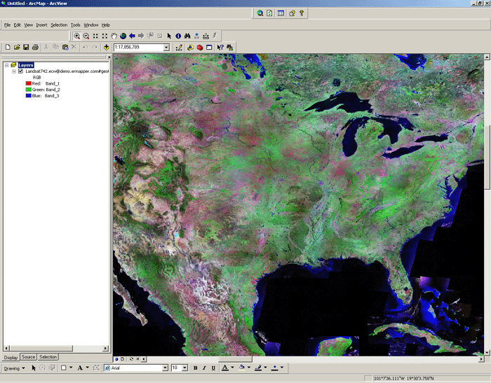
“You can use LIM to create your own mashups,” said Orchard. “ECWP allows fast deployment of large imagery datasets over narrow bandwidth applications. I can then download any of the images with permission given, using the ECW Image Service. Some people want to use their own applications, so for example, we can access imagery from Image Manager in ArcGIS Desktop.”
There are two ways to access images: one is as a WMS Service, pulling in imagery as you do with any other WMS Service, and the other way is to use ECWP protocol, a streaming imagery protocol that allows large amounts of imagery to be served up to thousands of clients on a single server. This offers faster response time to the user, less bandwidth and CPU or server power being used at the other end, according to Orchard.
When Orchard started the web client of LIM, he noted that it was part of Ionic Red Spider Enterprise and the Red Spider Image Archive product. The rapid imagery delivery was part of the ER Mapper Image Web Server product. Parts of ERDAS Imagine are also integrated for the image read write capabilities. This integration is all part of a larger business plan to produce specific products.
With the Leica Image Manager, Orchard said you can bring in multiple images and stack them on top of each other. “You don’t feel much difference. A massive image seems as light as a feather, it has the quality of weightlessness.”
Top News of the Week
Intermap Technologies announced that ESRI has agreed to distribute Intermap’s highly accurate 3D digital elevation models and images to its customers.
According to Brian Bullock, Intermap president and CEO, “This is a synergistic relationship for both parties. Combining ease of access to some of the most reliable and uniform digital elevation data with sophisticated GIS applications simplifies the end-user’s experience across a vast array of markets and industries. The complementary nature of a superior suite of geospatial software offered by ESRI, combined with off-the-shelf digital mapping data, is a win-win for everyone.”
ESRI's upcoming ArcGIS 9.3 software release will fully support the Microsoft Windows Vista operating system across the ArcGIS family of products. The new support now makes ArcGIS fully compatible with Vista for increased reliability.
Starting at the ArcGIS 9.2 Service Pack 4 release, ESRI added support for Vista in all the ArcGIS Desktop products: ArcInfo, ArcEditor, ArcView, ArcReader, ArcGIS Desktop extensions, ArcGIS Engine, and ArcInfo Workstation. ArcGIS 9.3 will add Vista support to ArcGIS Server (including ArcSDE and ArcIMS) and ArcGIS Image Server, helping to support the needs of developers building applications on top of these products.
Architects and urban designers Rosario Giusti de Pérez and Ramón A. Pérez spent years working on projects to revitalize barrios in their home country of Venezuela. In Analyzing Urban Poverty: GIS for the Developing World, their new book from ESRI Press, they explain how people can use geographic information system (GIS) technology to identify and manage ways of improving the quality of life in poor urban areas.
Analyzing Urban Poverty: GIS for the Developing World (ISBN 978-1-58948-151-0), 125 pages, $29.95) is available at online retailers worldwide, at ESRI Press, or by calling 1-800-447-9778. Outside the United States, contact your local ESRI distributor. Visit Distributors website for a current distributor list. Interested retailers can contact ESRI Press book distributor Ingram Publisher Services.
NCDC Imaging, a developer of Remote Sensing and GIS solutions, has been awarded a five-year, $5.2 million subcontract by SGT, Inc. Their work will support EROS in applying engineering principles to process Earth observation data along with information technology expertise to effectively manage and distribute information on natural resources, land characterization, and global climate changes.
Acquisitions/Agreements/Alliances
East View Cartographic (EVC) announced that it has completed the acquisition of all assets of the well-known Dutch mapseller RMIB Geosciences BV. The move strengthens EVC’s commitment to serving its growing European clientele through its own Dutch office, East View Information Services BV, based in Arnhem, The Netherlands.
Merrick & Company was awarded a LiDAR and digital imagery project by the City of Wichita to collect geospatial data for the City and in the remaining areas of Sedgwick County. Merrick will deliver six-inch pixel resolution color digital orthophotography that was simultaneously collected with LiDAR, a digital terrain model (DTM), one-foot contour coverage for the City, two-foot contours for the rural areas, and a drainage network and watershed boundaries for areas one-acre in size or larger for the entire County. Data acquisition aerial flights began this month and final City deliverables are scheduled for August 2008 with the remaining County data expected for delivery January 2009.
Announcements
The City of Toronto, Canada, has chosen ESRI's ArcGIS Survey Analyst software to maintain its survey, parcel, and cadastral data. With the tools and workflow available in the Survey Analyst extension of ArcGIS, the city will manage and continually enhance the accuracy of its cadastre using survey methodologies in a geographic information system (GIS) environment.
Security Service Federal Credit Union has reduced its market research time and increased its ability to view potential market areas by using BusinessMAP Financial (FSE) from ESRI. The solution allows Security Service to find useful demographic information about its target audience for areas surrounding current service centers to help it evaluate potential sites for new service centers.
At its recent annual channel partner conference, One Team Conference (OTC), Autodesk, Inc. honored 48 value-added resellers by inducting them into Platinum Club 2008, an elite group recognized for top sales performance and outstanding customer service in fiscal year 2008.
Data provider NAVTEQ will now offer a Small Municipal and County Street Data Enterprise License Agreement (ELA) as an accompaniment to the recently launched ESRI Small Municipality and County Government ELA program. Like ESRI's popular ELA for small governments, NAVTEQ’s Street Data ELA will follow a straightforward, tiered pricing schedule based on population and is available to municipalities and counties in the United States with populations of 100,000 or less. This customized NAVTEQ offer is available only through ESRI to any municipality or county that meets the population requirements.
James W. Sewall Company announces the opening of Sewall Helpdesk, a new client support center for users of Sewall-developed software and systems, including web-delivered applications, hosted map viewers, and desktop products. For fast, reliable technical support, users can access the center through a toll-free number during East Coast business hours and round the clock via e-mail.
Sewall Helpdesk is part of Sewall’s continuing efforts to deliver higher-value customer solutions in service of our clients’ unique, specific needs. For more information on Sewall’s web services, applications, and systems, please contact: Randall Cercopely at 843 851 4773; Email Contact
Analytical Surveys, Inc. announced that it has completed the acquisition of 100% of the common stock of Axion International, Inc. ("Axion"), through a merger of Analytical's newly formed subsidiary into Axion. Pursuant to the merger, the former shareholders of Axion received 36.8 million shares of Common Stock of Analytical, constituting approximately 90.7% of the issued and outstanding Common Stock of Analytical.
Pitney Bowes MapInfo, a global provider of location intelligence, announced that its flagship MapInfo Professional(R) application for business mapping and analysis will utilize the spatial enhancements in Microsoft(R) SQL Server(R) 2008 to provide customers with enhanced geographic and business data management. SQL Server 2008 customers will be able to directly access, visualize and analyze data from SQL Server 2008 with the sophisticated, user-friendly geographic and analytical capabilities of MapInfo Professional, providing an enterprise-wide information access and analysis tool for making more informed decisions.
The 14th Annual CalGIS Conference will bring together professionals in the field of GIS for a comprehensive overview of the many ways people and organizations use GIS in California and for California. The Conference will be held in Modesto, California from April 23rd-25th, 2008 at the Modesto Centre Plaza 1010 10th Street, Modesto, California 95354.
The California Geographic Information Systems Conference is a premier event offering unrivaled value to individuals and organizations in the GIS field. Attendees will find opportunities to boost both professional and organizational performance. This is a non-vendor specific event to showcase and promote GIS in our State and the individuals who work in this field. For more information on the conference, see the conference web page.
Awards
As one of 17 partner firms worldwide, ESRI International honors alta4 Geoinformatik AG with the "Partner of the Year 2008" award. The award was presented by ESRI-President Jack Dangermond himself to Ole Seidel and Oliver Schuck within the frame of the Int. Business Partner Conference in Palm Springs, CA.
People
TerraGo Technologies, provider of geospatial data distribution and collaboration solutions, announced that it has doubled its sales organization and appointed Jeff Young director of global business development. The personnel growth comes in response to a year in which sales of TerraGo Technologies’ products more than tripled as use of the GeoPDF geospatial data distribution and collaboration format expands. In his new role, Young will be responsible for helping TerraGo Technologies expand sales of its Map2PDF® solutions through business partnerships with strategic resellers and technology providers.
IDV Solutions, a provider of visual composite application software, announced the expansion of its executive team with the appointment of Scott Parker as Vice President of Sales and Channels.
The new leadership hire reflects the posture for growth as the company’s products and services are in demand in a variety of business sectors. Mr. Parker will be based out of the new IDV Solutions Washington DC based office. The fast adoption by the federal government has required a local presence to work directly with customers, system integrators and technology partners in the DC area.
New Products
If you need up-to-date information at the smallest level of census geography, GeoLytics offers a large selection of U.S. population, household, and housing estimates data at the census block level. There are over 8 million census blocks in the U.S. and we have 2008 estimates available at this very small level of geography. Use these granular data to do statistical analysis of population and housing distributions and target small geographical areas.
Our expanded variable list includes sex by age by race for the most precise population estimates available. We also have occupancy, owner vs. renter, households, families, and more. To view the complete list of variables, go to: Geolytics website
NAVIGON announced a bold solution to a conundrum that is as old as the consumer GPS category itself: how to provide consumers regular, easy access to quality map updates.
NAVIGON’s convincing response to the dilemma is FreshMaps, a new service that ensures NAVIGON GPS devices stay accurate and viable over the long haul by allowing users to download up to 12 map updates in three years. NAVIGON FreshMaps is available for all NAVIGON 7100, 5100, and 2100/2120 series devices and can be purchased online and at major North American retail outlets for $79.99 (MSRP).
NAVIGON unveiled the NAVIGON 2100 max and NAVIGON 2120 max personal navigation devices (PNDs) at CeBIT 2008, the world's most comprehensive showcase of digital technology. The North American products earn their name by incorporating ‘wow’ features found only on high-end devices. They are the latest additions to NAVIGON’s award-winning and successful 2100 series line.
Features include a widescreen 4.3 format, spoken driving directions via text to speech, and NAVIGON’s exclusive Reality View, which provides 3D guidance when approaching highway interchanges. Also new is DirectHelp, a feature that pinpoints a user’s location and provides instant links to nearby services such as hospitals, pharmacies, and roadside assistance.
The NAVIGON 2100 max ships with maps of the continental U.S. while the NAVIGON 2120 max features maps of the U.S. and Canada. The standard NAVIGON 2100 max device sells online and in stores for $299 (MSRP). The 2120 max is limited to distribution in Canada and sells for $329 CAD.
MetaCarta, Inc., provider of geographic search and referencing solutions, announced GeoSearch News, an innovative geographic search engine that displays current news on a map. GeoSearch News indexes an extensive collection of more than 1,400 national, international and local news sources every hour in addition to direct feeds from the Associated Press and Reuters. GeoSearch News provides users a single site on which they can learn what is happening now at any destination in the world.
Navman Wireless North America, a wholly owned subsidiary of Navman Wireless Holdings, and a global provider of vehicle tracking and fleet management solutions, announced powerful new enhancements to its next generation vehicle tracking and logistics software, OnlineAVL2. Providing the ultimate in fleet management functionality, Navman Wireless’ new cutting-edge capabilities come only two months after the new software’s premiere.
Cadcorp has announced the availability of a link between its Cadcorp SIS – Spatial Information System desktop GIS and i2 iBase 5 – i2’s analytical database solution.
The dynamic interface to iBase5 enables i2 to provide its users in the police service with the capability to integrate with Cadcorp SIS digital mapping/GIS software. It was developed using the rich API (application programming interface) available to users of Cadcorp SIS and i2 iBase GIS interfaces.
The interface allows users of iBase5 to transfer groups of selected entities to Cadcorp SIS so they can be seen in their geographical context and referenced to various GIS and other data sources such as OS MasterMap and aerial photography.
deCarta, supplier of software and services for the LBS industry, announced its real-time, two-way (RTTW) connected navigation service for next- generation personal navigation devices and smartphones. The service will be made available to carriers, handset manufacturers, consumer brands, automotive OEMs and in-vehicle service providers in Q3 2008. deCarta will be demonstrating its connected navigation platform, reference architecture and select applications in its booth at the upcoming CTIA Wireless 2008 conference (April 1-3, Las Vegas, NV).
Blue Marble Geographics announces their flagship data conversion tool, the Geographic Calculator, maintains a direct tie-in to the International Association of Oil & Gas Producers (OGP) online European Petroleum Survey Group (EPSG) Web Registry Service (WRS). Direct support of the OGP WRS Registry, which is used as a standard for the Oil & Gas Exploration industry, allows enterprises to update information when they need to, online in real time.
Upcoming Events
| Spatial Analysis for Business 2008 Conference | |
| Date: | April 5 - 8, 2008 |
| Place: | University of Redlands
Redlands, CA USA |
| The University of Redlands School of Business invites you to participate in the 2008 Spatial Analysis for Business Conference organized by the University of Redlands in partnership with the Small Business Administration and ESRI.
This conference brings together noted experts in Geographic Information Systems (GIS), researchers, and business professionals to create a unique learning experience. The conference will consist of refereed paper and panel presentations, workshops, hands-on GIS tutorials and key note speakers.
|
|
| URISA/NENA Addressing Conference (formerly GIPSC) | |
| Date: | April 7 - 10, 2008 |
| Place: | Doubletree Hotel - Lloyd Center
Portland, OR USA |
| The Urban and Regional Information Systems Association (URISA) and the National Emergency Number Association (NENA) have announced a new name for its joint conference. The 2008 conference will be the first one presented under this name: The URISA/NENA Addressing Conference.
|
|
| Map Middle East 2008 | |
| Date: | April 8 - 10, 2008 |
| Place: | Dubai World Trade Centre
Dubai, United Arab Emirates |
| Map Middle East 2008, the Fourth Annual Middle East Conference on Geospatial Information, Technology & Applications will provide a platform to showcase the innovative applications of the Geospatial domain.
|
|
| 2008 Southeast Regional User Group Conference (SERUG) | |
| Date: | April 14 - 16, 2008 |
| Place: | Hyatt Regency Riverfront
Jacksonville, FL USA |
| Join other Southeastern Regional GIS users April 14-16, 2008 to discuss challenges and solutions that are unique to your area. Learn from your colleagues about successful GIS applications in many business and government agencies that can provide new ideas and inspiration.
|
|
| AAG 2008 Annual Meeting | |
| Date: | April 15 - 19, 2008 |
| Place: | Marriot Copley Place and Westin Copley Place Hotel
Boston, MA USA |
| The Annual Meeting of the Association of American Geographers attracts geographers and related professionals from around the world. Our meeting forum stimulates discussion about research, education, accomplishments, and developments in geography.
|
|
| Disaster Management 2008 | |
| Date: | April 16 - 18, 2008 |
| Place: | Pragati Maidan, New Delhi, India |
| Disaster Management 2008 would be a platform to attract exhibitors from all over the world and would not only provide an opportunity to tap huge markets, but at the same time allow them to personally interact with the big-wigs of the industry.
|
|
| MAGIC 2008 Symposium | |
| Date: | April 20 - 24, 2008 |
| Place: | Kansas City, MO USA |
| GIS covers such a broad range of subjects, applications and types of people that use it, that developing a conference program that meets everyone’s needs is a challenging task. Even more challenging is an attendee trying to figure out exactly which sessions or topics will be most interesting and helpful. MAGIC 2008 is intended to focus the content of the presentation options into a program specifically geared to each attendee’s needs.
|
|
| 2008 Overwatch Users Group Conference | |
| Date: | April 21 - 24, 2008 |
| Place: | Westwood Country Club
Vienna, VA USA |
| We are pleased to announce the 2008 Overwatch Users Group Conference. The conference will be held at the Westwood Country Club in Vienna, Virginia on April 21-24. Each of our product development groups has been hard at work creating new features to help analysts and GIS users maximize their screen time. If you use RemoteView, ELT/Series, Feature Analyst, LIDAR Analyst, Urban Analyst or InterSCOPE, you should come to the conference
|
|
| 14th Annual CalGIS Conference | |
| Date: | April 23 - 25, 2008 |
| Place: | Modesto, CA USA |
The California Geographic Information Systems Conference is a premier event offering unrivaled value to individuals and organizations in the GIS field. Attendees will find opportunities to boost professional and organizational performance with access to:
|
|
| Delaware GIS 2008: A Spatial Network | |
| Date: | April 23, 2008 |
| Place: | Sheraton Dover Hotel
Dover, DE USA |
| The annual Delaware GIS Conference provides an opportunity to exchange ideas, share knowledge, and network with other professionals in the region. Each year this conference draws more than 200 geospatial professionals from a wide array of backgrounds including decision-makers, managers, educators, and state and local government staff.
|
|
| 2008 ESRI Business GIS Summit | |
| Date: | April 27 - 30, 2008 |
| Place: | The Drake Hotel
Chicago, IL USA |
| The ESRI Business GIS Summit is the leading forum for collaboration and networking with other users of business-focused GIS solutions. Business professionals from banking, health care, insurance, logistics, manufacturing, media, real estate, retail, utilities, and related industries are encouraged to attend.
|
|