Welcome to GISWeekly!
GISWeekly examines select top news each week, picks out worthwhile reading from around the web, and special interest items you might not find elsewhere. This issue will feature Industry News, Top News of the Week, Acquisitions, Agreements, Alliances, Announcements, People, Awards, New Products, Around the Web and Events Calendar.
GISWeekly welcomes letters and feedback from readers, so let us know what you think. Send your comments to me at
Email Contact
Best wishes,
Susan Smith, Managing Editor
Industry News
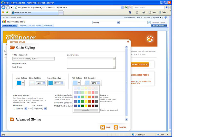
Building Geo-Enabled Mashups in Minutes
By Susan Smith
 [
Click to Enlarge ] [
Click to Enlarge ]
|
“It’s software that allows you to build apps,” noted Caulk. “Historically those have been geospatially focused, putting enterprise data on the map and then integrating all kinds of business systems with web data, SharePoint data and Excel files. Essentially any data source you can get your hands on we can integrate all on top of a map.”
 [
Click to Enlarge ] [
Click to Enlarge ]
|
Another enhancement in the new 4.0 release is extending the ability to create mashups for anybody. Within SharePoint, Visual Fusion has GUI tools called AppHub for “application hub” and Composer which was already part of the product and has been upgraded in this release.
 [
Click to Enlarge ] [
Click to Enlarge ]
|
Caulk said all their customers are moving to the newest version of the product.
Core benefits of Visual Fusion 4.0 are that users can create apps quickly. The second core benefit is the product is designed and built for the average business user and not necessarily the GIS professional.
Caulk also noted that IDV Solutions has a very deep SharePoint integration. With Visual Fusion you can build apps inside SharePoint, offering modified content types and leveraging workflow and site templates. SharePoint is a huge market for the company.
When users add any Office document (from Word, Excel, or PowerPoint) to a library built with a Visual Fusion template, they can specify a location. Visual Fusion automatically assigns latitude and longitude coordinates to the document. For Excel spreadsheets, Visual Fusion can assign coordinates to each row in the spreadsheet that has a location. Users in an enterprise can see the library that has been added to a mashup plus the geographic relationships and access any of the documents. There is also a template for geospatially enabling InfoPath forms, so that information that is added to these forms goes directly into the map without the user needing to import and program the information in.
Caulk said that the key capabilities of the 4.0 release is it ability to connect to any data source. It is truly designed for the business user rather than the GIS professional.
“It’s a platform with software to rapidly build your killer apps,” explained Caulk. “Most of our customers only deal with a singular problem – we’re uniquely positioned to help them solve that problem and give them something they really love. We may take a couple of months to build a killer app for them. At the same time, we’re the second bullet, we’re a platform to rapidly build killer apps, so it could just be just that one singular app that solves one particular problem or allows you to do maybe supply chain management. There are a lot of little apps that help out with any business question or issue that pops up today.”
Although most customers really want the first scenario of solving the single problem, Caulk said when enterprise mashups become popular within the enterprise, the other capabilities of Visual Fusion will become more popular too. Business users will be able to build dozens of apps themselves.
Visual Fusion is installed within SharePoint, so any data that’s in the SharePoint library or list is automatically discovered. The product has connectors to other data sources like SQL server, Oracle and ArcGIS, so the procedure for using those data sources is to set up a config file, an XML file to identify where the location of the server is, the name of the store, procedure or the table, then the user must define what attributes to grab out of that table. For those data sources for which Visual Fusion does not have a native connector, through the SDK a user can connect with other sources and various web feeds such as KML, WMS and GeoRSS.
When setting up layers, users have the option of setting a Z index. For anything serving as a base map, you will set the Z index low as possible. It is configurable so that you can set weather on top if you wish, or allow them to come in at the same level if you don’t set them.
IDV Solutions also released a mobile app called Contribute for the iPhone that can be installed with the Visual Fusion application. It enables the user to take a photo and attach comments to it and upload it to the SharePoint library, to be thereafter become part of the data feed automatically displayed in Visual Fusion.
Another product, SpatialWiki, is a drawing tool that allows anyone to produce points, lines and polygons in a simple user interface which are saved into a SharePoint library as KML. They can also be used in creating a common operational picture or to define areas.
Just last week IDV Solutions announced that Visual Fusion is integrated with the cloud on Microsoft’s Azure. The app can be seen in a public demonstration.
Top News of the Week
GISCafe Today is a new blog written by GISCafe and GISWeekly Editor, Susan Smith, which offers thoughts and insights on some of the more important announcements from the GIS/geospatial industry, plus an opportunity for readers to comment. Offering blogs is a way for us to extend our coverage of the numerous developments in the geospatial industry, so take a look and let us know what you think.
The National Weather Service Southern Region has purchased Freeance Mobile for the purposes of pushing ESRI map services out to BlackBerry Smartphones. The Southern Region plans on utilizing BlackBerry Smartphones for storm damage mapping and other related field events that require map viewing and GPS map point logging. Freeance Mobile will allow the National Weather Service to combine two existing platforms, ESRI ArcGIS and BlackBerry in-house with easy-to-use plug-and-play configuration software.
Acquisitions, Agreements, Alliances
Trimble announced it has acquired privately-held NTech Industries based in Ukiah, Calif. NTech is a leading provider of crop-sensing technology that allows farmers to reduce costs and environmental impact by controlling the application of nitrogen, herbicide and other crop inputs. The acquisition further expands Trimble's ability to offer innovative field applications for farmers. Financial terms were not disclosed.
CygNet Software, provider of enterprise operations platform for the oil and gas industry, announced it is partnering with ESRI through the ESRI Developer Program to integrate geographic information systems (GIS) capabilities and data into CygNet's next-generation SCADA offering.
ERDAS Inc. announces that TECNOGEO S.L. is now the official ERDAS distributor to customers in Spain and Andorra. Based in Barcelona, TECNOGEO has offices throughout Spain.
Digital Sandbox, Inc., provider of the Risk Analysis Center (RAC), a leading suite of advanced risk-management software and analysis services, has joined ESRI's Business Partner Program as an ArcGIS developer. The companies will be demonstrating their joint solutions at the 2009 National Urban Area Security Initiative (UASI) Conference June 9-11 in Charlotte, North Carolina.
IVS 3D announced its partnership with Geomatics Data Solutions to provide sales, support, and training to Fledermaus clients located on the western coast of North America.
Announcements
Organizations that face shrinking travel budgets and no-travel policies can still offer employees high-quality geographic information system (GIS) software training. ESRI trains GIS professionals at their workplaces by providing on-site training, coaching, and video teleconferencing, in addition to self-study classes over the Internet.
"These training choices help ESRI software users keep their skills up-to-date even if their organizations have cut back on travel to off-site training locations," said Ralph Luchs, ESRI training delivery manager.
ESRI recently added two new training options to help GIS professionals who must remain near the office.
Building on their proven track record of providing quality GIS and SharePoint integration solutions to the E&P community, Idea Integration, creator of Constellation, has licensed the OpenSpirit Software Developer Kit to OpenSpirit-enable the Constellation 2.0 framework. Geoscientists will have seamless access to multiple geological and geophysical applications, and a single unified view and dashboard of corporate upstream assets.
People
Peter Batty, a leading technologist within the global geospatial industry will be presenting in the opening plenary session of AGI’s GeoCommunity ’09 conference.
Pictometry International Corp. announces the appointments of Major General (Ret.) Bruce M. Lawlor and Ian Aaron, President and CEO of Twistbox Entertainment, Inc., to the Pictometry Board of Directors.
New Products
Z Corporation released zp150, a premium composite build material for its ZPrinter 450 and ZPrinter 650 3D printers. zp150 improves the strength and color of 3D printed models for 3D CAD while producing whiter whites for applications such as architectural modeling where true white is the traditional standard.
TatukGIS has released the 2.0 upgrade of its desktop GIS Editor product with significant new features such as advanced support for coordinate systems, many new data formats, and scripting for customizing or extending the Editor beyond its core features. While the core product remains intuitive and easy to use, the new scripting features make the Editor also appropriate for specialized situations requiring advanced level GIS functionality. A free trial version is available from the TatukGIS web site.
Spatial Business Systems announced the release of Version 3.4 of the Smallworld Plug-in for FME, a high-performance data translation product that can be used to extract and load data from GE Smallworld to numerous other geographic information system (GIS) products via Safe Software’s Feature Manipulation Engine (FME).
The next-generation release of ArcGIS Business Analyst Online, ESRI's popular hosted geographic information system (GIS), provides a rich and intuitive Web 2.0 experience for customer segmentation, market analytics, and site evaluation. The new version takes full advantage of the latest Web technology and has been designed to allow users to start analyzing data and performing investigation without any software training.
With the release of GIS Tutorial II: Spatial Analysis Workbook, ESRI Press has expanded its instructional workbook offerings to benefit geographic information system (GIS) users at the intermediate level.
Building on the basic skills taught in GIS Tutorial: Workbook for ArcView 9, GIS Tutorial II teaches readers how to perform spatial analysis using the tools in ArcGIS Desktop. Detailed, step-by-step procedures are included to guide them in a number of spatial analysis methods including comparison, overlay, density, proximity, statistical, temporal, distribution, pattern, cluster, autocorrelation, and hot spot.
TerraServer announced the launch of subsidiary company RealUp, a new commercial real estate information company. The beta site officially launched May 17, 2009 and is available to the public at www.RealUp.com. RealUp offers commercial real estate professionals free memberships, unlimited free searching, free recent sales comparables, free lending quotes and interactive listings.
Free Stuff
Global Map Systems Inc. (GMS) announced their free map viewing solution. GMS has partnered with Glyph & Cog to offer map users an industry-specific free PDF viewer for spatial analysis. This new release offers map-makers an ideal way to deliver location intelligence and true GIS analysis to field technicians, construction crews, military and Homeland Security personnel that need an easy way to work with native mapping data.
Around the Web
Speak the Same Language ArcUser Online
Events
| Intergraph 2009 | |
| Date: | June 15 - 18, 2009 |
| Place: | Gaylord National Resort & Convention Center
Washington, DC USA |
The Gaylord National serves as the anchor tenant for Washington D.C.’s newest premier destination – National Harbor – a one-of-a-kind waterfront development on the banks of the Potomac River. This destination will provide you with a prime location to network with Intergraph customers from around the world while enjoying D.C. and all its attractions. | |
| ENCOM Discover 3D for Mineral Exploration | |
| Date: | June 15 - 16, 2009 |
| Place: | Vancouver, BC, Canada |
The Discover 3D course makes use of the skills you gained in the MapInfo Professional and encom Discover courses to help you visualize your geological data in 3D. This course is of most benefit to those geologists working on a drillhole program. | |
| GSDI 11 World Conference | |
| Date: | June 15 - 19, 2009 |
| Place: | Rotterdam, Netherlands |
The theme for this conference is Spatial Data Infrastructure Convergence: Building SDI Bridges to Address Global Challenges. Geographic information technologies and spatial data infrastructure play critical roles in allowing governments, local communities, non-government organizations, the commercial sector, the academic community and common people to make progress in addressing many of the worlds most pressing problems.
| |
| First Open Source GIS UK Conference | |
| Date: | June 22, 2009 |
| Place: | University of Nottingham
Nottingham, United Kingdom |
The Centre for Geospatial Science of the University of Nottingham, Open Source Geospatial Foundation (UK Chapter), ICA Working Group on Open Source Geospatial Technologies, SOSoRNET and Open Knowledge Foundation are organizing the First Open Source GIS UK Conference on Monday 22nd June, 2009 at the University of Nottingham. | |
| IRON GIS AMERICA | |
| Date: | June 23, 2009 |
| Place: | 12353 E. Easter Ave
Suite 200 Centennial, CO USA |
Today's competitive business environment and increasing regulations have required organizations to become more diligent about their Geospatial Information Systems (GIS) and how data is being collected. This has meant that business units advocating or using GIS must now compete for their share of a limited, and often shrinking, budget and to “do more with less”. | |
| MAPPS Summer Conference | |
| Date: | June 25 - 29, 2009 |
| Place: | Ocean Edge Resort & Club on Cape Cod
Brewster, MA USA |
This will be the second time the association has held a summer conference on the Cape, the last time being 1992 in Hyannis, MA. The Summer Conference will focus on emerging technologies, education and networking. The MAPPS summer conference is open to private geospatial firm. The conference allows for unique networking opportunities for principals, owners and senior executives of private geospatial firms.
| |
| Fourth International Workshop on "Geographical Analysis, Urban Modeling, Spatial Statistics" | |
| Date: | June 29 - July 2, 2009 |
| Place: | Kyung Hee University-Global Campus
Yongin , Korea (South) |
The growth of Spatial Data Infrastructures, Geo-portals and private sector initiatives (e.g. Google Earth, Microsoft Virtual Earth, etc.) produced an increase of geographical data availability at any scale and worldwide. This growth has not been fully coupled by an increase of knowledge to support spatial decisions. Spatial analytical techniques and geographical analysis and modelling methods are therefore required in order to analyse data and to facilitate the decision process at all levels.
| |
| ENERegion Summer School 2009 | |
| Date: | June 29 - July 10, 2009 |
| Place: | Salzburg, Austria |
The ENERegion Summer School 2009 is dedicated to the theme of "Regional Potentials for Renewable Energy Generation" and is hosted by Salzburg University's Centre for Geoinformatics (Z_GIS).
| |
| GISLERS - Summer School 2009 | |
| Date: | July 3 - 14, 2009 |
| Place: | Salzburg, Austria |
The Z_GIS Summer School 2009 is dedicated to the theme of Bridging Geographic Information Science (GIS), Landscape Ecology (LE), and Remote Sensing (RS) for landscape analysis and landscape planning and is hosted by Salzburg University's Centre for Geoinformatics (Z_GIS).
| |
| The Geoinformatics Forum Salzburg 2009 | |
| Date: | July 7 - 10, 2009 |
| Place: | Salzburg, Austria |
The Geoinformatics Forum Salzburg 2009 focuses on an international GIScience audience, communicating in English and sharing an interest in translating new methods and techniques into a broad range of application domains in geoinformatics. | |
| 2009 ESRI Survey & Engineering GIS Summit | |
| Date: | July 11 - 14, 2009 |
| Place: | San Diego , CA USA |
Discover how to enhance your business practices and expand your capabilities with the technology that is shaping the future of geospatial data management and analysis. | |
| 2009 ESRI Education User Conference | |
| Date: | July 11 - 14, 2009 |
| Place: | San Diego, CA USA |
The EdUC is your best opportunity to explore how GIS promotes critical thinking, computer literacy, and time- and money-saving best practices for institutions. | |
| 2009 ESRI Homeland Security GIS Summit | |
| Date: | July 11 - 14, 2009 |
| Place: | San Diego Convention Center
San Diego, CA USA |
Attend the only geospatial conference dedicated to homeland security, now a convenient concurrent event with the 2009 ESRI International User Conference.
| |
| 2009 ESRI Business GIS Summit | |
| Date: | July 12 - 15, 2009 |
| Place: | San Diego Convention Center
San Diego, CA USA |
Explore the value of GIS for your organization. Whether you’re new to geographic information system (GIS) technology or looking for innovative ways to develop your current projects, be part of this collaborative forum that brings business professionals and industry leaders together. See how business GIS solutions provide a more competitive edge, drive business innovation, and increase ROI; learn more about the critical advantages of GIS at this premier event. | |
| 2009 ESRI International User Conference | |
| Date: | July 13 - 17, 2009 |
| Place: | San Diego, CA USA |
This conference is your ultimate GIS resource, a place to extend your GIS skills, connect with your GIS community, and reenergize yourself and your work. | |
| IGARSS 2009 | |
| Date: | July 13 - 17, 2009 |
| Place: | Cape Town, South Africa |
The venue for IGARSS 09 has been chosen as the University of Cape Town on the slopes of Table Mountain. The choice of Cape Town, the first time that IGARSS will be held on the African continent, represents a milestone in the IEEE Geoscience and Remote Sensing Society’s strategic objective to broaden international participation, particularly in the developing countries.
| |
| GEOBrasil Summit 2009 | |
| Date: | July 14 - 16, 2009 |
| Place: | Imigrantes (Convenções)
São Paulo , Brazil |
GEOBrasil Summit presents new trends, products and services earmarked for integrated solutions connected with mapping, localisation, navigation, geographic localisation and analysis for management of public and private companies. Integrated events: GEOBrasil, GNSS Navis, GEO Oil & Gas and GEOCities. | |